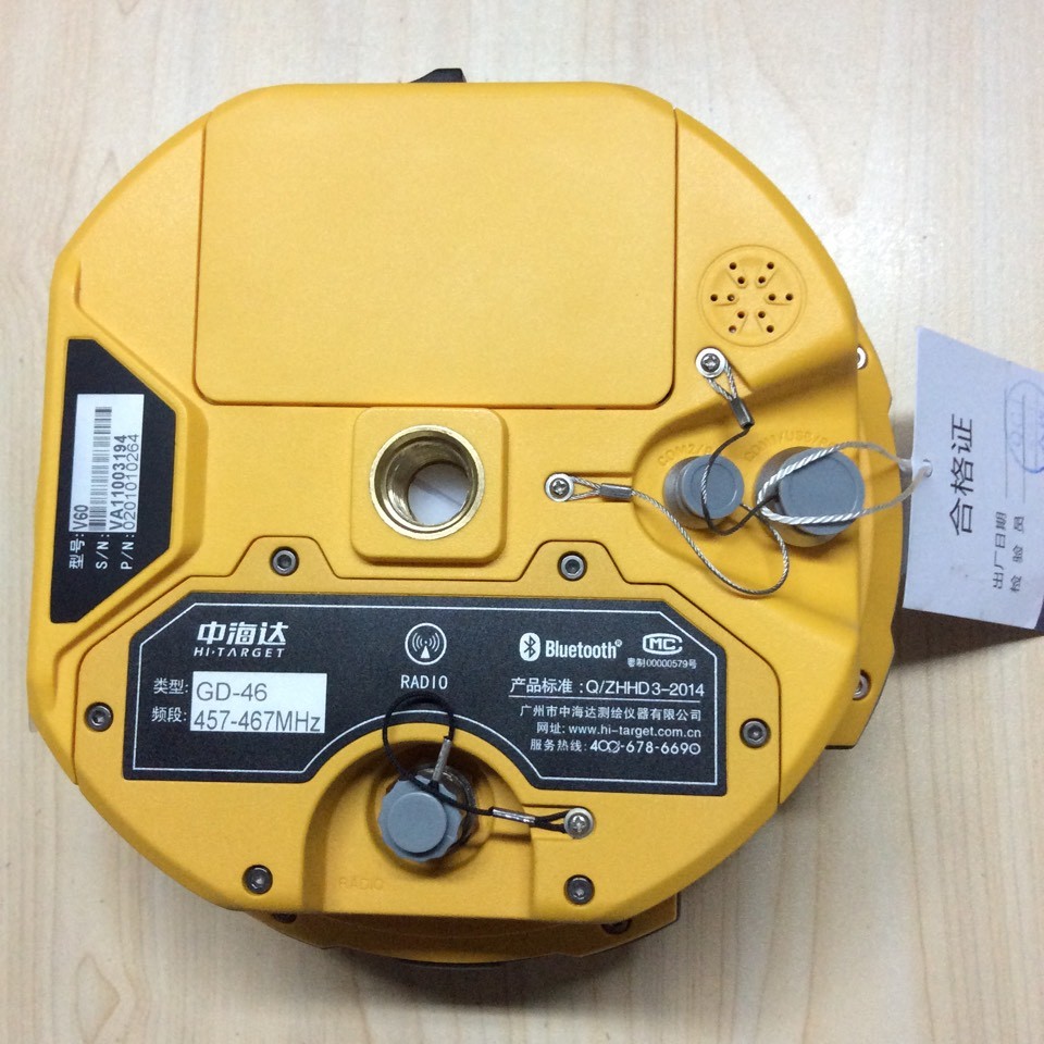
Model NO.: V60
Carrier Frequency: Dual-Frequency
Chip: MStar
Brand: Hi-Target
Certification: ISO/TS16949, ISO14001, ISO2000
Gnss Solutions: Gnss Antenna
Surveying and Construction: Mapping and Gis
Environment Studies: Geomarking
Archaeology: Accident Reconstruction
as-Built Surveys: Topographic Surveys
Right-of-Way Surveys: Tentative Maps
Electrical Distribution: Traffic Control Planning
Traffic Signal Design: GPS Navigator
GPS Navigation: Gnss Antenna
Gnss Receive: Data Collector
Trademark: Hi-Target
Transport Package: Cartonbox
Specification: CE/ISO/FCC
Origin: Chongqing
HS Code: 9002209000
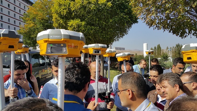
Hi-Target GPS Glonss Survey GPS Equipment for Topographic Surveys GPRS GPS /GSM GPS /3G GPS Â for Network RTKÂ V60 GNSS RTK SYSTEM
The V60 is a more compact-design and higher-performance GNSS RTK system, besides its rugged design to resist impact and vibration. The V60 has industrial OLED display screen on its front control panel to show all information and status of the work. With the smart speaker inside the receiver, the DIY guiding voice can be customized in any language, even dialect! 1GB internal storage plus 8GB Micro SD card memory is standard, the V60 supports up to 32GB extension of memory. The V60 is fully compatible with other GNSS RTK receivers from the world market. The static data can be saved directly in RINEX format.
System Features:
Small and lightweight  Â
Only weighs 950g.Â
Measures Diameter 153mm x Height 83mm.
Multi-constellation TrackingÂ
220 tracking channels
Supports GPS, GLONASS, GALILEO, BDS, SBAS
NGS approved full-band GNSS antenna
Smart Application Â
 Offers tilt survey with a maximum tilt angle of 30 degrees.Â
Supports electronic bubble calibration
 The internal NFC module makes Bluetooth communication quick and easy.
Intelligent voice assistance guides field operations. Voice can be DIY.
Standard Rinex data and HI-TARGET raw data recorded simultaneously.
Optional Transceiver UHF Radio Â
The transceiver UHF radio enables switchable working modes between base and rover.
Three types of internal UHF radio provide different frequencies based on users requirements. The Pacific Crest TrimTalk© internal UHF radio is compatible with other radios.
Multi-network Connection
Supports GPRS, GSM and WCDMA
Supports WIFI
Powerful Battery
Powered by high-capacity (5000mAh) Li-ion battery to ensure full day operation
Rugged Design
IP67 dustproof and waterproof
Able to survive a 3-meter natural fall onto concrete
Linux Operation System
ARM 9G20 400MHz CPU, embedded Linux OS to support faster data transmission.
 Intelligent Operation
Equipped with smart speaker guiding during the whole operation. Voice assistance can help you master V60 operation quickly. Language can be customized.
 Industrial LED display screen on its front control panel to show all information and status of the work.
 Many one-button operations make your work easily. Base setup by one button can choose base coordinate from base list automatically.
 Automatic recording system log makes receiver diagnosis easy.
 RINEX Storage
The static data can be saved directly in RINEX format. The V60 is fully compatible with other brands' receivers.
 Quick Upgrade
Just copy the updated firmware to the V60, then restart to finish the upgrade in a few seconds.
 Multi Constellation Tracking
 220 tracking channels.
 Supports GPS, GLONASS, GALILEO, BDS, SBAS.
 Built-in NGS Approved Antenna.Â
High Power Transceiver UHF Radio
The transceiver UHF radio enables the working mode switchable between base and rover.
5 watts (Max.) HI-TARGET internal UHF radio and 2 watts (Max.)Pacific Crest micro XDL internal UHF radio are optional
 Pacific Crest TrimTalk© internal UHF radio is compatible with other RTK.
 Seamlessly Operation in CORS System
 Built-in GPRS/GSM/3G module makes V60 work perfectly with network RTK positioning.
 Long-life Battery
Powered by 5000mAh Li-Ion battery.
Static working time 13 - 15 hours
RTK Rover(UHF/GPRS/3G) working time 10 - 12 hours
 RTK Base working time 8 - 10 hours
 Rugged Design, IP67
 IP67 dust/water protection.
 Withstands 3 meters natural fall onto concrete.
 Rapidly track and perfectly avoid or lessen obstruction and multipath effect to ensure superior positioning capability.
 Â
 |
Technical Parameters | ||||
| Â Â Â Â Measurements |
 220 tracking channels |
|||
| Advanced Pacific Crest Maxwell 6 Custom Survey GNSS Technology | ||||
| High precision multiple correlator for GNSS pseudo range measurements | ||||
| Unfiltered, unsmoothed pseudo range measurements data for low noise, low multipath error, low time domain correlation and high dynamic response | ||||
| Very low noise GNSS carrier phase measurements with <1 mm precision in a 1 Hz bandwidth | ||||
| Signal-to-Noise ratios reported in dB-Hz | ||||
| Proven Pacific Crest low elevation tracking technology | ||||
|  Satellite signals tracked simultaneously |
GPS: Simultaneous L1C/A, L2C, L2E, L5 | |||
| GLONASS: Simultaneous L1C/A, L1P, L2C/A (GLONASS M only), L2P | ||||
| SBAS: Simultaneous L1 C/A, L5 | ||||
| Galileo: Simultaneous L1 BOC, E5A, E5B, E5AltBOC | ||||
| BDS: B1, B2 | ||||
| QZSS: L1 C/A, L1 SAIF, L2C, L5 | ||||
| Â Â Â Positioning Accuracy |
 Static and Fast Static GNSS surveying |
Horizontal: 2.5mm+0.5ppm RMS  Vertical: 5mm+0.5ppm RMS |
||
| Stop & Go GNSS surveying | Horizontal: 1cm+1ppm RMS Vertical: 2.5cm+1ppm RMS Initialization time: typically 10 minutes for base while 5 minutes for rover Initialization reliability: typically > 99.9% |
|||
| Realtime Kinematic(RTK) surveying | Horizontal: 8mm+1ppm RMS Vertical: 15mm+1ppm RMS Initialization time: typically < 8 seconds Initialization reliability: typically > 99.9% |
|||
|  | Code Differential GNSS positioning | Horizontal: 25cm+1ppm RMS  Vertical: 50cm+1ppm RMS  SBAS[iv]:0.50mHorizontal,0.85m Vertical |
||
|        Hardware            |
         Physical |
1.Dimensions (W x H): 19.50cm x 10.40cm(7.68 in x 4.09 in)  2.Weight: 1.3kg (2.86lb) with internal battery, internal radio, standard UHF antenna  3.Operating temperature: -45ºCto +65ºC (-49ºF to +149ºF)  4.Storage temperature: -55ºC to +85ºC (-67ºF to +185ºF)  5.Humidity: 100%, considering  6.Water/dustproof: IP67 dustproof, protected from temporary  7.immersion to depth of 1m (3.28ft).  8.Shock and Vibration: Designed to survive a 3m(9.84ft) natural fall onto concrete. 9. Storage: 64M |
||
| Â Â Â Â Â Electrical |
1.Power 6V to 28V DC external power input  2.Power consumption 2.5W  3.Automatic Switching between internal power and external power  4.Rechargeable, removable 7.4V, 5000mAh Lithium-Ion battery in internal battery compartment  5.Internal battery life, Static 13 - 15 hours, RTK Rover (UHF/GPRS/3G) 10 - 12 hours and RTK Base 8 - 10 hours  |
|||
|              Communication  |
GPRS/GSM or 3G |  Fully integrated, fully sealed internal GPRS/GSM or 3G Network RTK (via CORS) range20-50km |
|
| HI-TARGET internal UHF radio (standard) | Frequency: 460 MHz with 116 channels  Transmitting Power: 0.1W, 1W, 2W adjustable  Transmitting Speed: Up to 19.2Kbps  Working Range: 3~5Km typical, 8~10km optimal |
||
| PacificCrest XDL micro Internal UHF Radio (Optional) |
Frequency: 403~473 MHz  Transmitting Power: 0.5W, 1.0W, 2.0W adjustable  Transmitting Speed: Up to 19.2Kbps  Support most of radio communication protocol Working Range: 3~5km typical, 8~10km optimal |
||
| HI-TARGET External UHF radio (standard) | Frequency: 460 MHz with 116 channels  Transmitting Power: 5W, 10W, 20W, 30W adjustable  Transmitting Speed: Up to 19.2Kbps  Working Range: 8~10Km typical, 15~20km optimal |
||
| Pacific Crest ADL Vantage Pro External UHF radio (Optional) |
Frequency: 390~430 MHz or 430~470 MHz  Transmitting Power: 4W to 35W adjustable  Transmitting Speed: Up to 19.2Kbps  Support most of radio communication protocol  Working Range: 8~10Km typical, 15~20km optimal |
||
Â